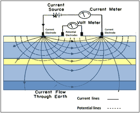
• Need – With the help of a resistivity survey, we can effectively map aquifer zones, which are zones of high porosity and permeability. Aquifer zone in turn gives an idea of groundwater resources available. It can also be used in mining and other geotechnical investigations.


  • Field Work – Current and potential electrodes are planted as per the array defined for vertical profiling and sounding. Current is supplied to the ground and potential in turn is calculated. This process continues until the entire area is covered. 


  • Deliverable – Based on variation between the values of current and potential, a graph is plotted and the zones with lower resistivity are identified by a person skilled in the geophysical process.
Resistivity Survey
Toyo GeoTech Pvt. Ltd.(Formerly Toyo Computers Pvt Ltd)
Close Search Window