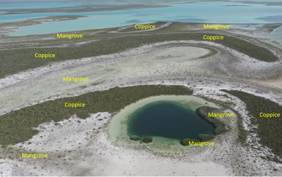
Map for Mangrove cover
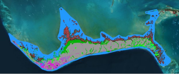
The primary focus of this work was creating the most accurate map of mangrove cover for blue carbon work within The Bahamas.
This was done by integrating the field knowledge and interpretation of high resolution imagery.
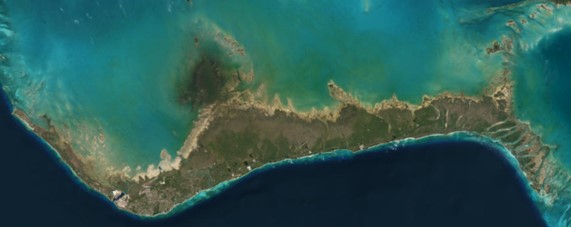
A total map area of 34,275 sq km was prepared.
Review and classification was done for classes like Water, Coppice/Pine, Transition, Barren apart from Mangroves and dwarf mangroves.
Hi-res imagery of Google Earth, Microsoft Bing and ESRI image base maps available in Quantum GIS (QGIS) was used for classification.


Toyo
Quick Links
Toyo GeoTech Pvt. Ltd. (Formerly Toyo Computers Pvt. Ltd.)
EL-125, Electronics Zone, MIDC, Mahape, Navi Mumbai, 400710 INDIA
info@toyogeotech.com
+91-70455 74744