Land Parcel Mapping for a Planned Township
Key Aspects of the Project:
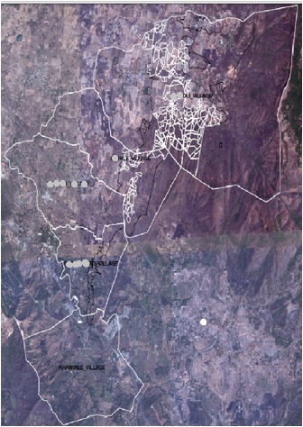
The project involves Survey of land parcels spread over 650 acres, Digitization, Geo-referencing and converting all provided data into GIS format.
Services Rendered and Methodology:
The main objective involve Survey, Digitization, Geo-referencing and converting all existing data into GIS format. Map different layer, boundaries, roads, river, buildings, utilities etc. Prepare queries and reports from the available data.
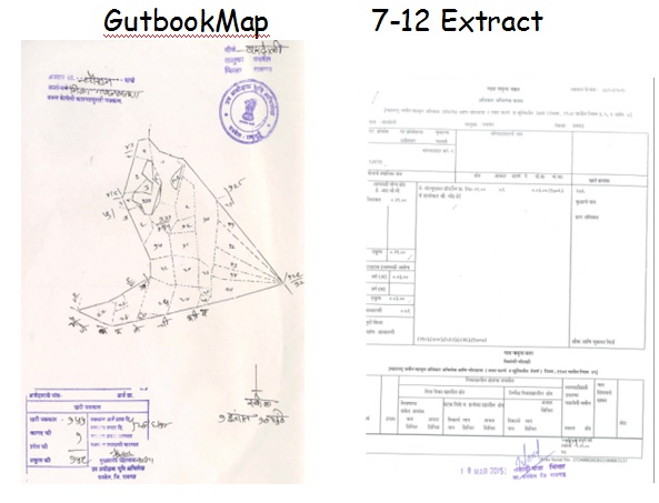
Extract data information of various land records like 7/12, Gat book, TILR, village maps, legal issues etc. and attaching all required documents and maps to each parcel of land record.


Toyo
Quick Links
Toyo GeoTech Pvt. Ltd. (Formerly Toyo Computers Pvt. Ltd.)
EL-125, Electronics Zone, MIDC, Mahape, Navi Mumbai, 400710 INDIA
info@toyogeotech.com
+91-70455 74744