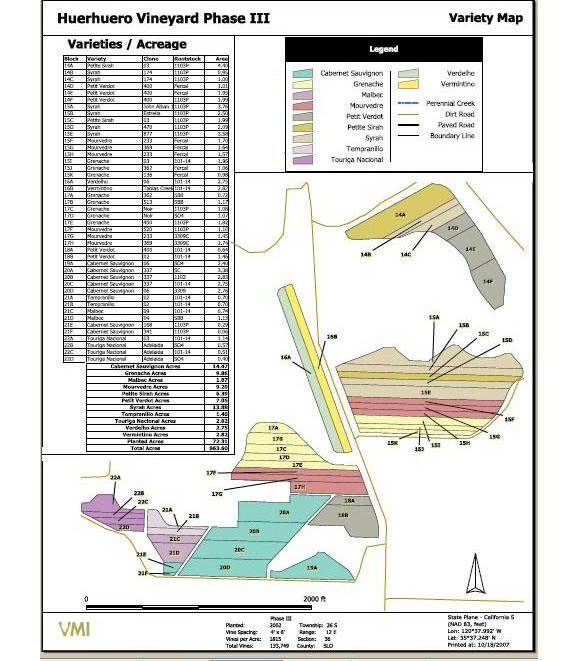
Creation of Maps and layouts for GIS report generation of vineyards
Using the input like GPS receiver output, Google earth maps and other satellite imagery, field information details like area, crop status, type of soil, climate etc., maps were created for several vineyard fields of California, USA. VPN network connectivity enabled us to directly connect the SQL server database of the client.


Toyo
Quick Links
Toyo GeoTech Pvt. Ltd. (Formerly Toyo Computers Pvt. Ltd.)
EL-125, Electronics Zone, MIDC, Mahape, Navi Mumbai, 400710 INDIA
info@toyogeotech.com
+91-70455 74744